A day trip to Montserrat
A mountain range an hour outside of Barcelona that requires a train, cable-car and funicular to get to? Sign me up.

2018/06/02
1/2000s at f/7.1, 53mm, ISO 200, Fuji X-T20
My overriding impression and memory of Montserrat is of it being a utterly bonkers landscape. Completely improbable in appearance. It dominates the horizon as you fly in to Barcelona - an otherwise flat landscape is suddenly punctured by this weird and steep serrated mountain range.

Barcelona ― 2018/06/04
1/30s at f/5.6, 24mm, ISO 2500, Fuji X-T20

Barcelona ― 2018/06/04
1/30s at f/3.6, 24mm, ISO 640, Fuji X-T20
More in straight-on
2018/06/04
1/150s at f/4.0, 24mm, ISO 200, Fuji X-T20
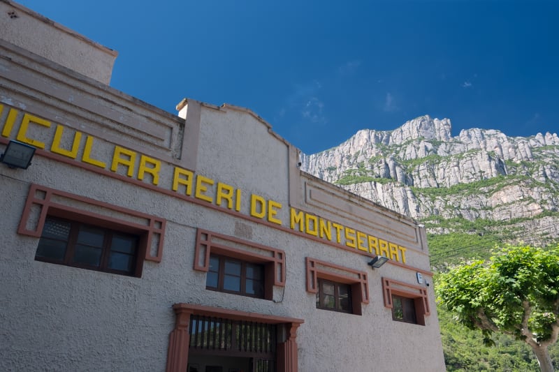
More in signs
2018/06/04
1/160s at f/4.0, 15mm, ISO 200, Fuji X-T20
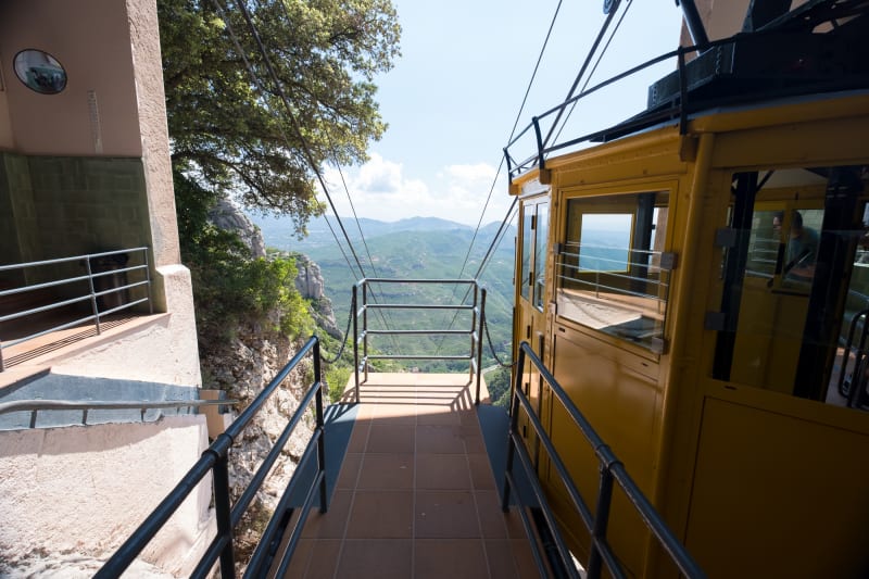
From the train station you can choose to take a cable car or a rack railway to the Montserrat monastery. Because of stupidity I can only put down to short-sightedness by the operators, you can’t choose one for your outbound and the other for your return.
2018/06/04
1/350s at f/4.0, 15mm, ISO 200, Fuji X-T20
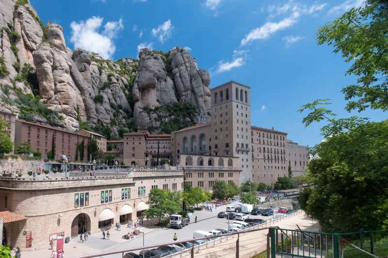
The town and monastery look like a set out of Game of Thrones.

2018/06/04
1/100s at f/1.8, 28mm, ISO 25, iPhone 7
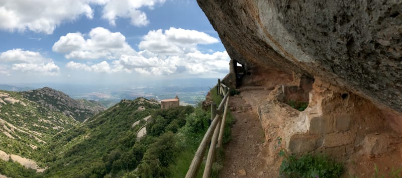
Several short funiculars are available from the town to further up the mountainside. You can also hike up, but these cut out some less interesting parts of the ascent. Plus, it’s a funicular!

Ermita de Sant Joan on the Montserrat hills.
Ermita de Sant Joan ― 2018/06/04
1/240s at f/8.0, 29mm, ISO 200, Fuji X-T20
2018/06/04
1/5000s at f/1.8, 28mm, ISO 20, iPhone 7
Not wanting to double back on myself, I found a path on OpenStreetMap that would lead me to the summit of Sant Jeroni. It wasn’t marked on the public maps, but how badly can OpenStreetMap lead me? The answer is very.
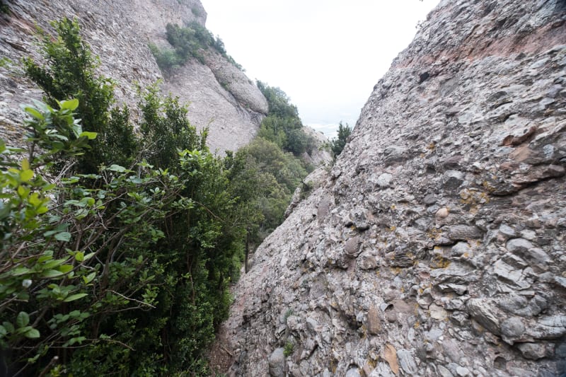
Do you see a path? I don’t see one.
2018/06/04
1/70s at f/4.0, 15mm, ISO 200, Fuji X-T20
The ‘path’ was 100% not a thing, and meant an hour of hair-raising descent down the side of the mountain (wearing trainers), clutching at branches as I went down. I was very glad when I eventually joined a real path heading up to the summit.

2018/06/04
1/80s at f/7.1, 36mm, ISO 200, Fuji X-T20
The peaks of the mountains look like something from a cartoon book - or perhaps formed in a giant lava lamp. Bulbous and absurd. I think they look so ‘off’ because they don’t ‘taper’ away like most mountains - and they don’t look eroded in the same way.
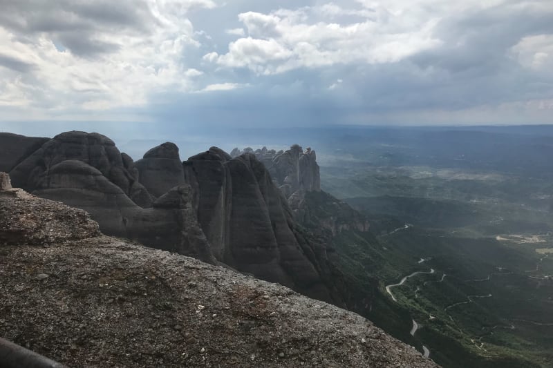
View from the top of Sant Jeroni.
Sant Jeroni ― 2018/06/04
1/5300s at f/1.8, 28mm, ISO 20, iPhone 7
In Catalan, Montserrat literally means “saw mountain”.

View from the top of Sant Jeroni.
Sant Jeroni ― 2018/06/04
1/1600s at f/1.8, 28mm, ISO 20, iPhone 7
Within 30 seconds of my arrival on the summit it started to rain, followed by fog, followed by fog and rain. Somewhat of an anticlimax. Queue a proper drenching.
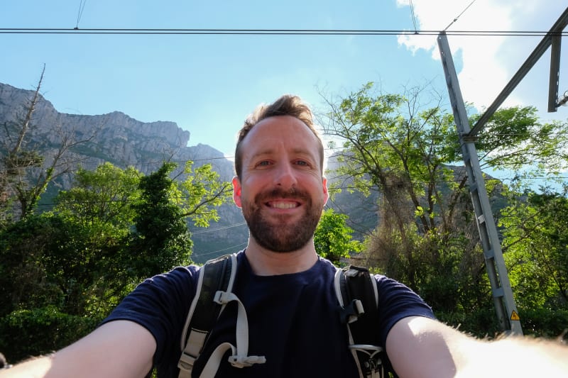
Ed Horsford ― 2018/06/04
1/350s at f/6.4, 15mm, ISO 400, Fuji X-T20
More in self-portraits
Sunny at the base though.

2018/06/04
1/150s at f/5.0, 26mm, ISO 200, Fuji X-T20